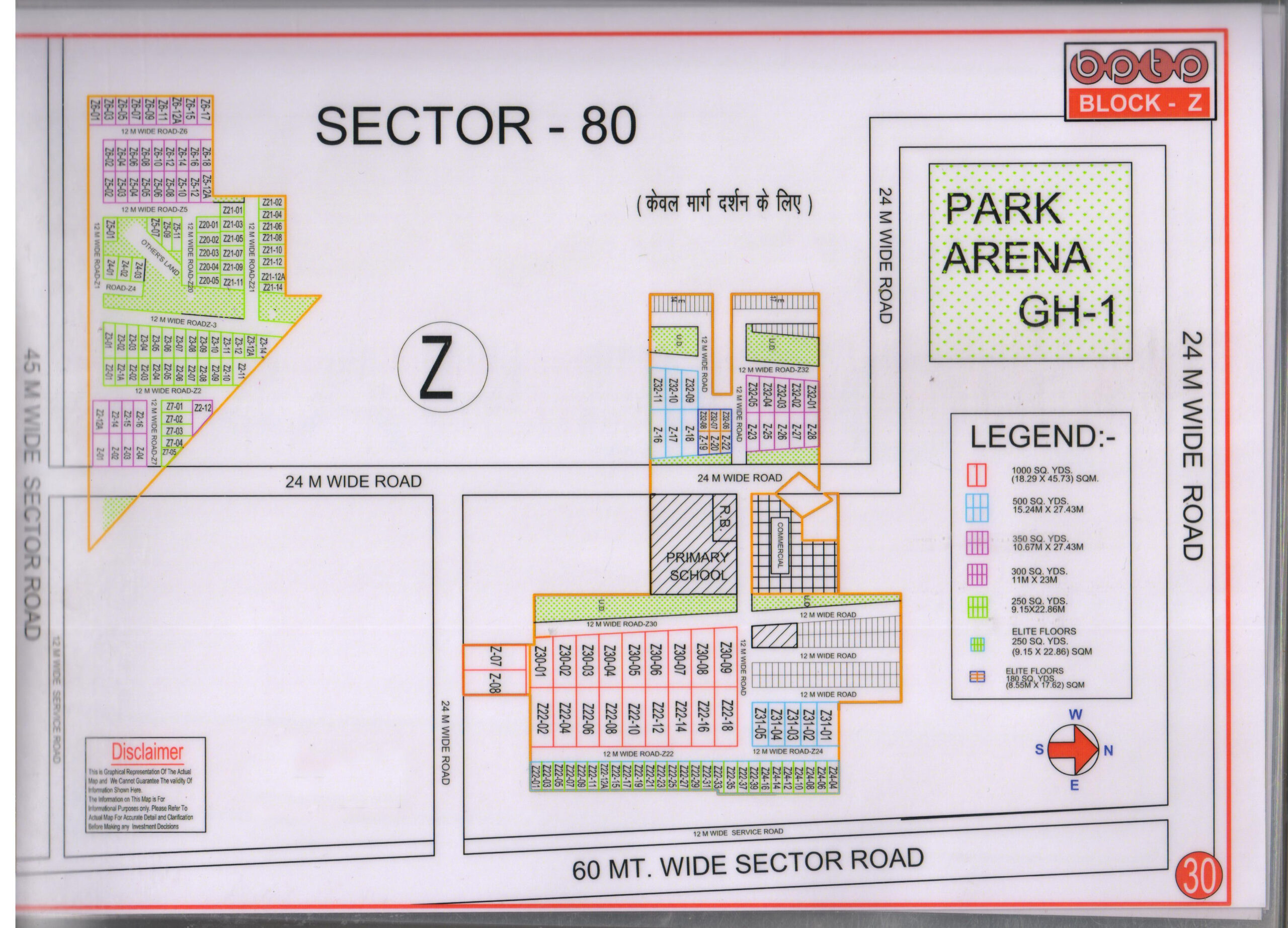
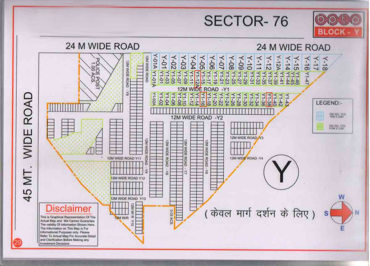
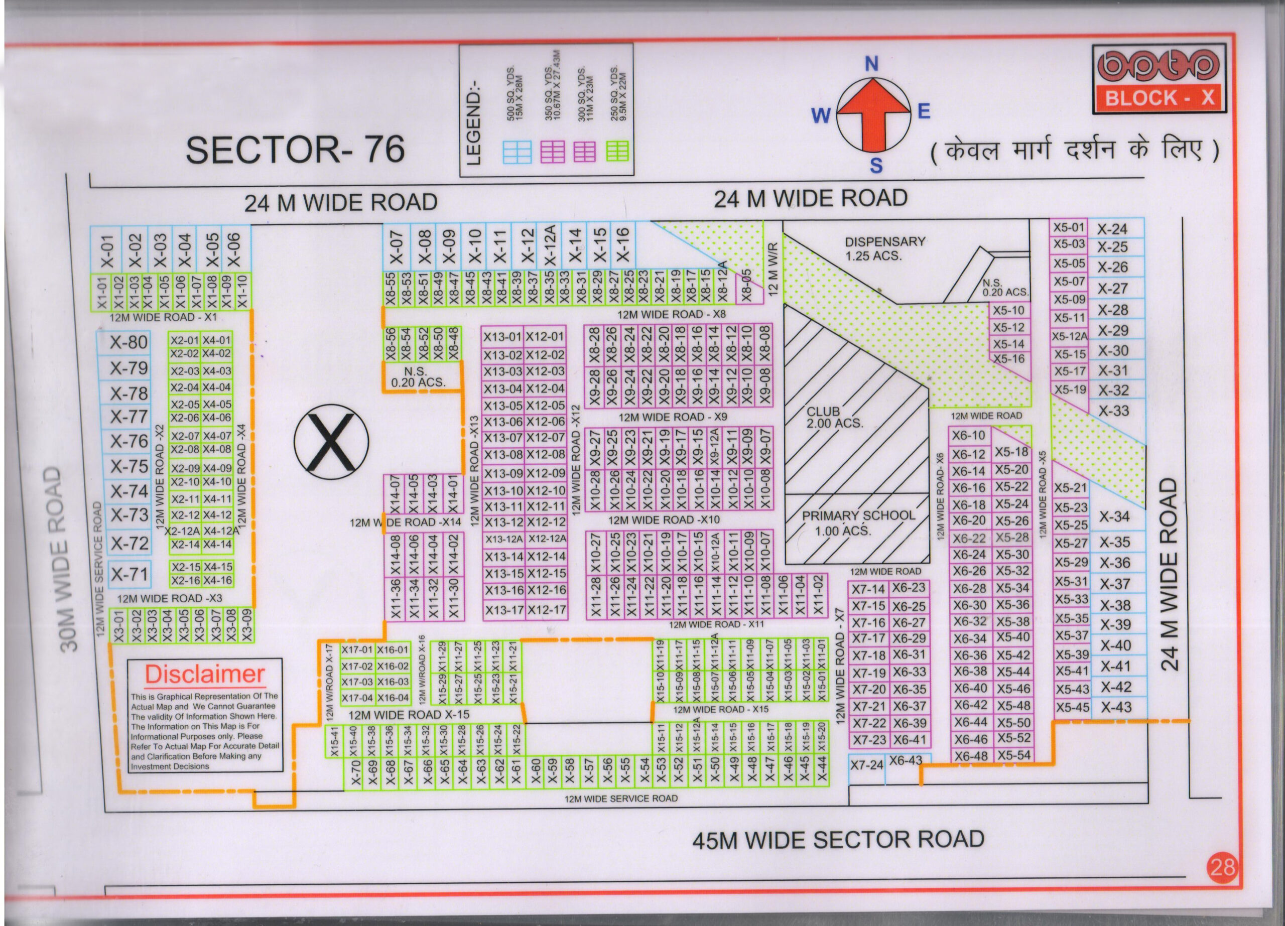
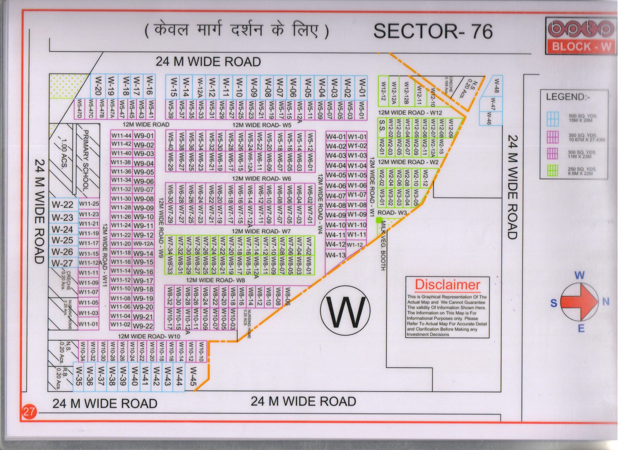
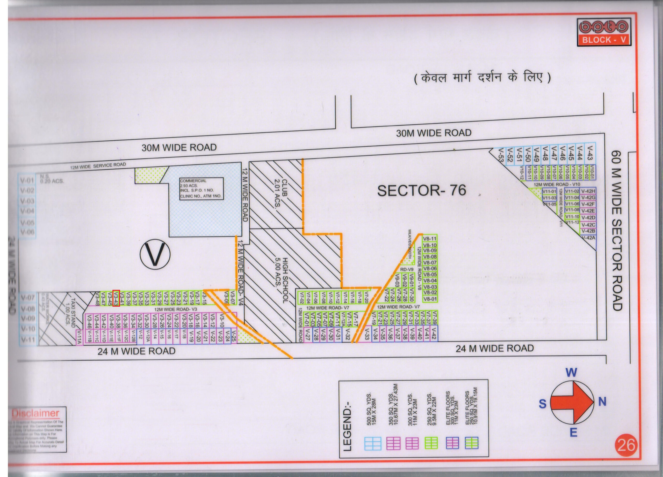
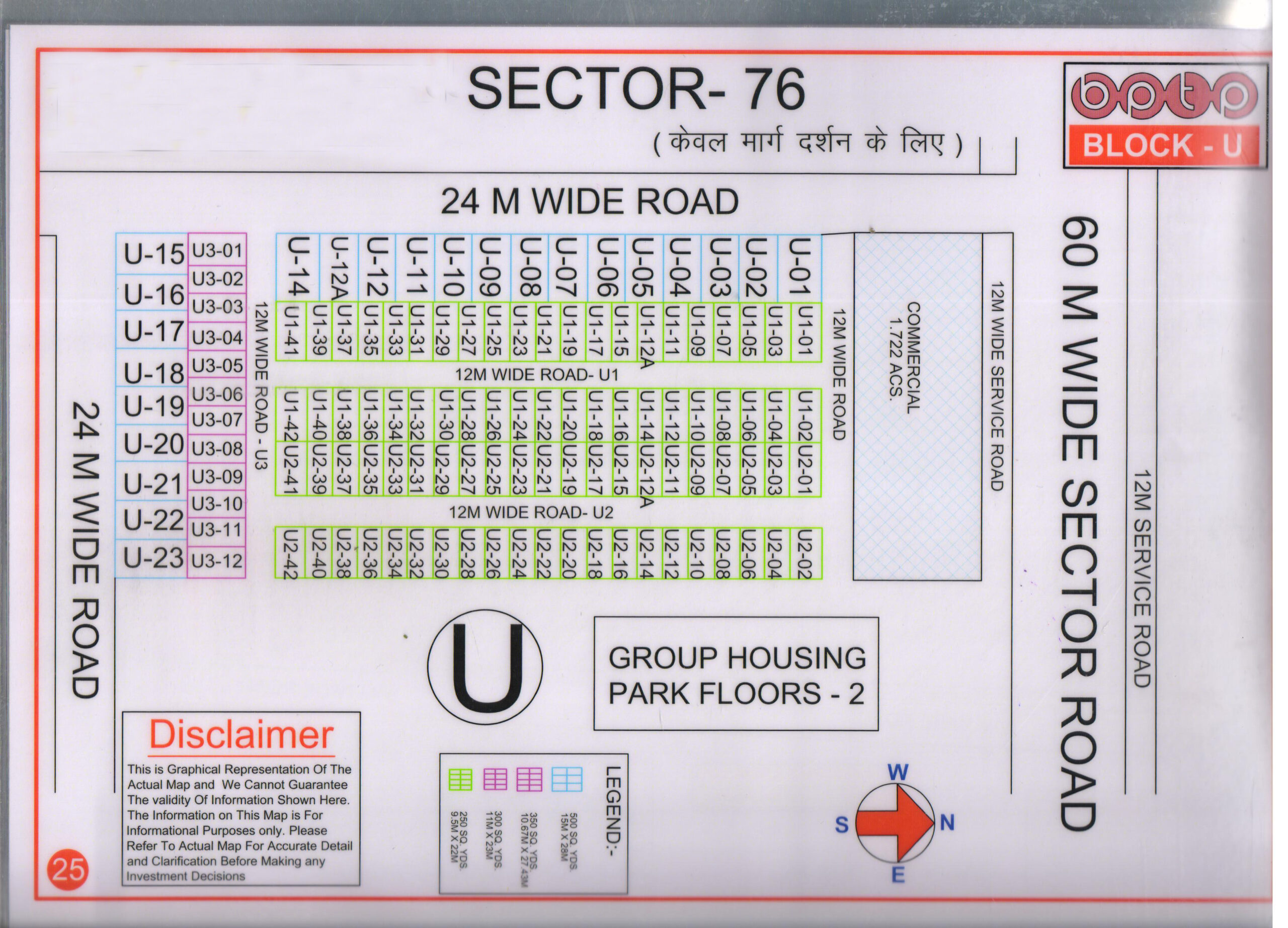
HUDA Sector 15A Faridabad Plots Map
June 5, 2025
Explore the map to view sizes, Details of Plots in HUDA Sector 15A Faridabad Plots Map.
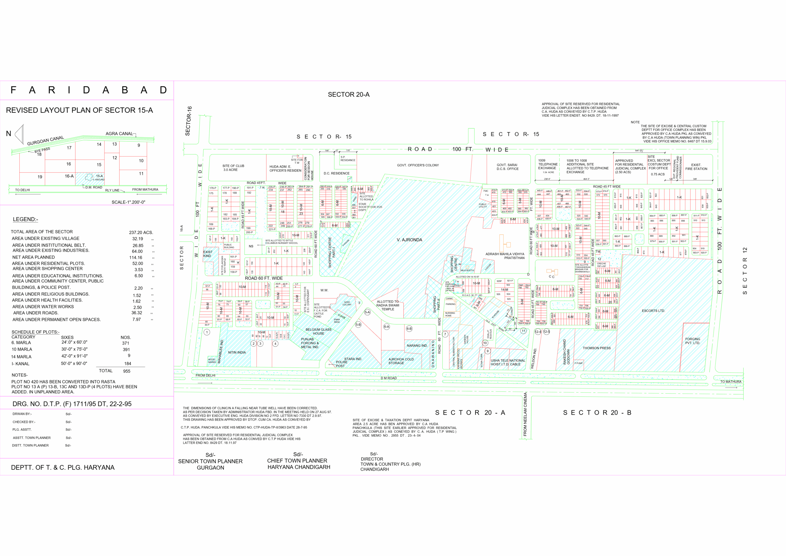
Map of HUDA Sector 15A Faridabad Plots Map locality
Legend
| Description | Area (in Acres) |
|---|---|
| Total Area of the Sector | 237.20 |
| Area Under Existing Village | 32.19 |
| Area Under Institutional Belt | 26.85 |
| Area Under Existing Industries | 64.00 |
| Net Area Planned | 114.16 |
| Area Under Residential Plots | 52.00 |
| Area Under Shopping Center | 3.53 |
| Area Under Educational Institutions | 6.50 |
| Area Under Community Center, Public Buildings & Police Post | 2.20 |
| Area Under Religious Buildings | 1.52 |
| Area Under Health Facilities | 1.62 |
| Area Under Water Works | 2.50 |
| Area Under Roads | 36.32 |
| Area Under Permanent Open Spaces | 7.97 |
Schedule of Plots
| Category | Sizes | No. of Plots |
|---|---|---|
| 6 Marla | 24′-0″ x 60′-0″ | 371 |
| 10 Marla | 30′-0″ x 75′-0″ | 391 |
| 14 Marla | 42′-0″ x 91′-0″ | 9 |
| 1 Kanal | 50′-0″ x 90′-0″ | 184 |
| Total | 955 | |